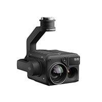
Zenmuse L1 - Instant Clarity. Superior Accuracy.
A Lidar + RGB Solution for Aerial Surveying
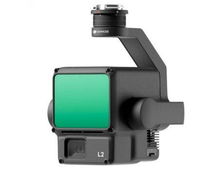
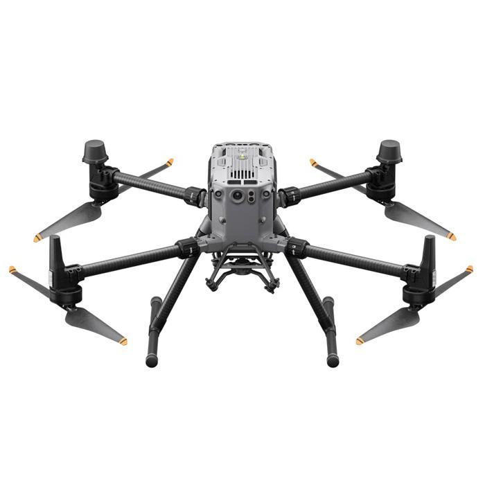
The Zenmuse L1 integrates a Livox Lidar module, a high-accuracy IMU, and a camera with a 1-inch CMOS on a 3-axis stabilized gimbal. When used with Matrice 300 RTK and DJI Terra, the L1 forms a complete solution that gives you real-time 3D data throughout the day, efficiently capturing the details of complex structures and delivering highly accurate reconstructed models.
Integrates a Lidar module, an RGB camera, and a high-accuracy IMU
High Efficiency 2 km2 covered in a single flight
High Accuracy Vertical Accuracy: 5 cm / Horizontal Accuracy: 10 cm
Point Rate: 240,000 pts/s
Supports 3 Returns
Detection Range: 450 m (80% reflectivity, 0 klx)
IP44 Ingress Protection Level
Point Cloud LiveView
Digitize without Compromise
Exceptional Efficiency
Generate true-color point cloud models in real-time, or acquire 2 km2 of point cloud data in a single flight [1] using the Livox frame Lidar module with a 70° FOV and a visible light camera with a 1-inch sensor.
Unparalleled Accuracy
Render centimeter-accurate reconstructions thanks to the high-accuracy IMU, a vision sensor for positioning accuracy, and the incorporation of GNSS data.
Ready When You Are
The IP44 rating allows the L1 to be operated in rainy or foggy environments. The Lidar module’s active scanning method enables you to fly at night.
Visualize Data as You Fly
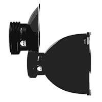
Livox Lidar Module
Frame Lidar with up to 100% effective point cloud results
Detection Range: 450m (80% reflectivity, 0 klx) / 190 m (10% reflectivity, 100 klx)
Effective Point Rate: 240,000 pts/s
Supports 3 Returns
Line Scan Mode and Non-repetitive Petal Scan Mode
Everything in View
RGB Camera
20MP
1-inch CMOS
Mechanical Shutter
Accurate Details at Your Disposal
High-accuracy IMU
Accuracy: 0.025° (roll/pitch) / 0.08° (yaw)
Vision Sensor for Positioning Accuracy
GNSS, IMU, RGB Data Fusion
Recreate the World in 3D Point Clouds
Point Cloud LiveView
Real-time point clouds provide immediate insights onsite, so operators are informed to make critical decisions quickly.
You can also verify fieldwork quality by checking point cloud data immediately after each flight.
Measurement and Annotation
Acquire and communicate critical dimensions on the point cloud model using measurements and annotations.
One-stop Post-processing
DJI Terra fuses the IMU and GNSS data for point cloud and visible light calculations, in addition to conducting POS data calculations so you can effortlessly generate reconstructed models and accuracy reports.
Application Scenarios
Topographic Mapping
Quickly generate topographic maps using accurate digital elevation models.
AEC and Surveying
Manage the full project lifecycle using highly accurate point clouds and 3D models.
Emergency Response
Any time of the day, gather critical insights in real-time using true-color point clouds.
Law Enforcement
Gain situational awareness and forensic intel in real-time to make informed decisions on site.
Energy and Infrastructure
Model sparse or complex structures in detail to manage them efficiently and safely.
Agriculture and Forestry Management
Gain insight into vegetation density, area, stock volume, canopy width, and growth trends.
 UAE
UAE KSA
KSA